Polzeath to Padstow
Walk
Cornwall Coast Path
Cornwall Information & Accommodation Guide

Polzeath to Padstow
3.4 miles (5.5 km) 1 hr 3 minutes.
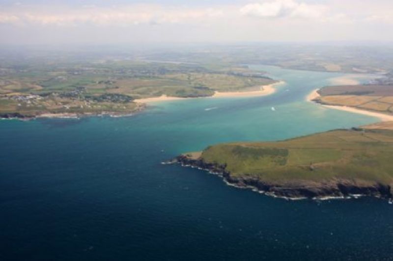
This section of the coastal footpath takes you along the estuary of the River Camel from one of North Cornwall's favourite beaches, Polzeath, to one of the most well known towns in Cornwall, Padstow. You can make a small detour if you wish to visit St Enodoc Church where Sir John Betjeman, the former Poet Laureate is buried. The section of path between Polzeath and Daymer Bay is mostly negotiable for wheelchairs. The shore and marine environment at Polzeath is Voluntary Marine Conservation Area.
Polzeath has a large sandy beach. Although referred to usually as Polzeath Beach, it is properly called Hayle Bay. Walk along the road past the large beach car park until you come to a sharp left-hand bend. Turn right here to join the coast path towards Daymer Bay.
The path leads you round a grassy field above the beach. On the side of the main beach at its southern extreme is a small sandy cove, bordered by rocks, called Trestram Cove.
Continue on the flat path and you will soon reach Broadagogue Cove. There is a coarse sandy beach here where dogs are welcome all year round. Just offshore is Vinnick Rock, probably from the Cornish word for stony.
The path leads to Greenaway Beach, also dog friendly. Shag Rock can be seen on Greenaway Beach. Likely named after the sea bird often seen fishing around the coastline.
The path soon reaches Trebetherick Point. In Cornish Trebedrek, meaning 'farm/settlement of Pedrek'. Pedrek could be Saint Petroc who is associated with Padstow and Bodmin.
Continue along the coast path. The hamlet of Greenaway is just inland. You have now reached Daymer Bay. This beautiful bay is popular with kitesurfers and windsurfers.
Depending on the tide, you can walk across the beach or follow the path behind it.
The almost round hill on your left is Brea Hill. It is 203ft high (62 metres). There are several Bronze Age burial mounds (tumuli) on the top of the hill. 'Bre' is Cornish for 'hill'. There is a small disused quarry on the inland side of Brea Hill. The quarrying operation was small scale and exploited 'greenstone' or dolerite. The best geological exposures are at sea level.
The path now takes you very close to Brea Beach. At low water, this beach joins with Rock Beach. Brea Beach is backed by sand dunes.
After Brea Hill the path veers slightly inland. Keep right at the fork in the path. Follow the path through the dunes. These dunes are a Site of Special Scientific Interest due to their flora and geology.
You will soon pass Cassock Hill (164 ft 50 metres). The geology of the hill is Devonian slate with wind-blown sand.
If the tide is low you can see the Doom Bar across the River Camel, not the real ale brewed in Rock which is named after it, but the sand bar on which many ships have foundered - over 600 capsizes, wrecks and beachings since records began in the early 1800s.
The coast path passes two small disused quarries. You are now at Rock Beach. You can explore the beach and the village and find refreshment in one of Rock's cafes or bars for a while or head to the ferry point.
The pedestrian ferry runs daily until dusk approx. every 20 minutes.
Depending on the state of the tide the ferry will embark and disembark from different points. Please see Padstow - Rock Ferry Schedule for details.
For the purpose of this description we will use St Saviour's Point as the landing point. Your ferry trip will take 5-10 minutes.
You disembark at St Saviour's Point. There is a War Memorial here.
The access into Padstow is via a mostly tarmac path which is easily negotiable for wheelchairs, mobility scooters and pushchairs.
Instead of immediately continuing along the coast path towards Stepper Point, take the footpath through St Saviour's Park into Padstow, where you can enjoy the cafes, galleries, boutiques and the Camel Trail.
Public Transport
Polzeath to Wadebridge
Service 10
Operated by Transport for Cornwall
Wadebridge to Padstow
Service 11A
Operated by Transport for Cornwall
Visit Cornwall Public Transport for latest timetable
OS Explorer Map 106 - Newquay and Padstow
All ATMs throughout Cornwall.
If the information on this website has been useful to you please consider a donation.
This easy to use travel planner makes it simple. Just add the location in Cornwall from where you are travelling and the destination you wish to travel to and it will provide full details of times, buses, trains and ferries to get you to your destination.
Books online:
Click here to buy books online about Polzeath to Padstow - Walk - Cornwall Coast Path
Find all the Dog Friendly beaches in Cornwall
Places of interest in or around Polzeath to Padstow - Walk - Cornwall Coast PathTowns, villages and other locations |
Cornish phrases and place names |
Topical phrases of the month January: 'New Year's Resolutions'
Place Name of the Month January: Tre at Last!
|
Polzeath to Padstow - Walk - Cornwall Coast Path Map |
|
Polzeath to Padstow - Walk - Cornwall Coast Path Events |
|
Polzeath to Padstow - Walk - Cornwall Coast Path Community Information |
|
Polzeath to Padstow - Walk - Cornwall Coast Path Books |
|
Polzeath to Padstow - Walk - Cornwall Coast Path Photos |
|
Polzeath to Padstow - Walk - Cornwall Coast Path Videos |
|
Polzeath to Padstow - Walk - Cornwall Coast Path History |
Polzeath to Padstow
Walk
Cornwall Coast Path
Accommodation
in or around Polzeath to Padstow
Walk
Cornwall Coast Path

|
|


