Marazion to Perranuthnoe
Walk
Cornwall Coast Path
Cornwall Information & Accommodation Guide

Marazion to Perranuthnoe - 1.9 miles (3 km)
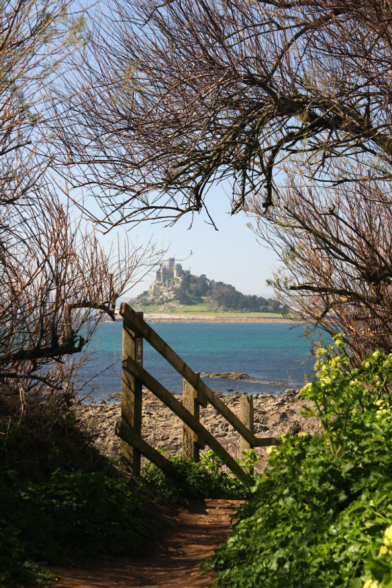
This part of the Cornwall coast path will take you further along the southern sweep of Mount's Bay past several small National Trust beaches, all of them dog friendly, and providing you with excellent views of St Michael's Mount. The walking is fairly easy, mostly flat with no steep gradients.
1. From Marazion Post Office walk along Fore Street in an easterly direction, up through the town.
Having passed a number of shops and galleries the road is now lined by small quaint cottages.
2. Proceed uphill onto Higher Fore Street, passing The Fire Engine Inn on your right.
3. A short distance further you will pass the Mount Haven and just after this accommodation there is a lane to your right which leads down to the sea. Follow this lane almost to its end before turning left onto the coast path, following the acorn marker.
The path hugs the coastline.
4. Walk past Venton Farm.
Venton Cove is below you. if you are interested in geology, Venton Cove contains several geological exposures - a rhyolite contact with meta sediments and a small hydrothermal breccia exposure.
5. Ignore the path inland and follow the coast path around Trenow Cove.
This cove is managed by the National Trust. Of interest to geologists, Trenow Cove has major outcrops of greenstones at (SW 530 300). The path leads you through the remains of old mines, formerly Trenow Consols which produced copper during the mid 1800s.
The large rock offshore is known as the Frenchman.
6. The coast path continues to follow the shoreline around Basore Point.
This point is interesting geologically. Gabbroic rocks are exposed, probably dating from the same period when Devonian sediments were deposited. Interesting geological feature at SW 532 295.
7. Below you is Trevelyan Cove also managed by the National Trust.
8. Ignore the path inland and continue around the next small headland. Temis Cove lies below the path.
Temis Cove is of geological interest with coarse greenstone cutting across pillow lavas.
The small islet off Temis Cove is called The Greeb.
The next headland is Maen-du Point. Maen du is Cornish for black rock.
There are the remains of a Second World War pillbox here. This would have provided a defensive capability, helping to protect the bay from German invasion.
The field above Maen-du Point was formerly known as 'The Carns', which could indicate it being an archaeological site containing prehistoric burials.
9. The coast path heads inland slightly emerging at the car park on the road above Perranuthnoe Beach. The beach is known as Perran Sands.
Public Transport
Bus service U4 Penzance to Marazion to Perranuthnoe All Year Round
Service operated by Transport for Cornwall.
Visit Cornwall Public Transport for latest timetables
OS Explorer Map for this walk 102 - Land's End, Penzance and St Ives
All ATMs throughout Cornwall.
If the information on this website has been useful to you please consider a donation.
This easy to use travel planner makes it simple. Just add the location in Cornwall from where you are travelling and the destination you wish to travel to and it will provide full details of times, buses, trains and ferries to get you to your destination.
Books online:
Click here to buy books online about Marazion to Perranuthnoe - Walk - Cornwall Coast Path
Find all the Dog Friendly beaches in Cornwall
Places of interest in or around Marazion to Perranuthnoe - Walk - Cornwall Coast PathTowns, villages and other locations |
Cornish phrases and place names |
Topical phrases of the month January: 'New Year's Resolutions'
Place Name of the Month January: Tre at Last!
|
Marazion to Perranuthnoe - Walk - Cornwall Coast Path Map |
|
Marazion to Perranuthnoe - Walk - Cornwall Coast Path Events |
|
Marazion to Perranuthnoe - Walk - Cornwall Coast Path Community Information |
|
Marazion to Perranuthnoe - Walk - Cornwall Coast Path Books |
|
Marazion to Perranuthnoe - Walk - Cornwall Coast Path Photos |
|
Marazion to Perranuthnoe - Walk - Cornwall Coast Path Videos |
|
Marazion to Perranuthnoe - Walk - Cornwall Coast Path History |
Marazion to Perranuthnoe
Walk
Cornwall Coast Path
Accommodation
in or around Marazion to Perranuthnoe
Walk
Cornwall Coast Path
Things to do
in this area

|
|


