Marsland Mouth to Hawker's Hut, Morwenstow
Walk
Cornwall Coast Path
Cornwall Information & Accommodation Guide

Marsland Mouth to Hawker's Hut, Morwenstow (2.5km 1.55 miles)
This stage of the coast path contains several steep climbs and descents. Located in the Parish of Morwenstow
1. The walk begins at Marsland Mouth
Marsland Water approaches the sea through the Marsland Valley Nature Reserve and at the footbridge which crosses the stream just above Marsland Beach, you find yourself on the border between Devon and Cornwall - Marsland Mouth . The stream tumbles over the cliff creating one of many waterfalls along the route.
2. Walk in a southerly direction (keeping the sea on your right) uphill onto the 400ft (122m) Marsland Cliff.
Below Marsland Cliff is Gull Rock and Devil's Hole (best viewed from Cornakey Cliff and Yeolmouth Cliff a little later in the walk). The path descends into Litter Mouth where another waterfall tumbles to the beach.
3. Cross the stream then climb the path to Cornakey Cliff.
You can now look back and see the rock arch - Devil's Hole - in Gull Rock.
4. After walking along Yeolmouth Cliff the path descends to Yeol Mouth, where there is another waterfall. The coast path climbs again up onto Henna Cliff - 459ft (140m) high.
Below you the rocks of Westcott Wattle form the southern boundary of Yeol Mouth.
5. The path descends again into a valley. Cross the footbridge across the stream.
The stream becomes a waterfall pouring down onto the rocks below.
6. The coast path now climbs again onto Vicarage Cliff.
In this area, down a steep path on the cliff face is St Morwenna's Well. The path to the well is fairly dangerous so do not attempt it unless you have the correct equipment or unless the access has now been improved.
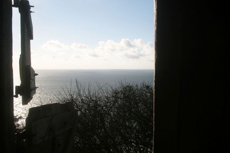
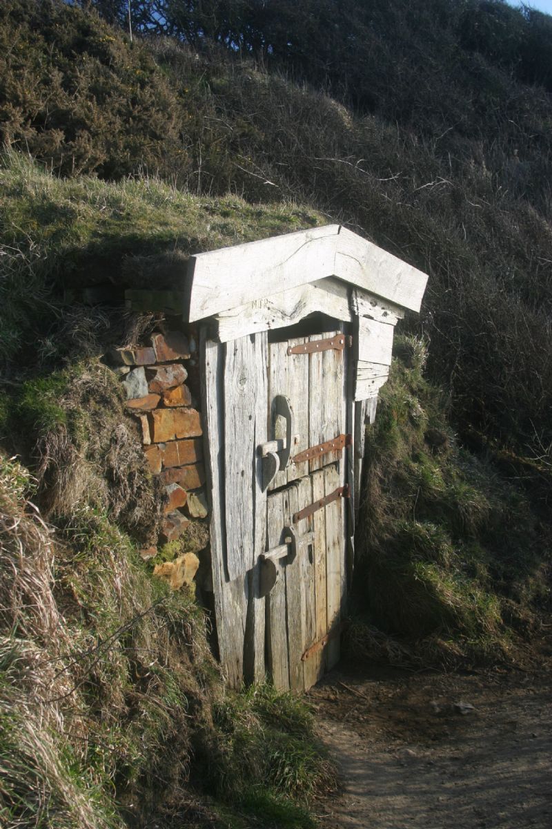
Walking along Vicarage Cliff, look out for the path down to Hawker's Hut. The Reverend Hawker spent many hours here contemplating the sea, writing and even entertaining guests. Below Hawker's Hut the cliffs are very popular with rock climbers with several climbs around Vicarage Cliffs and the Lucky Hole.
Shipwrecks were very frequent on this section of the coast - at least 150 vessels have been lost on the rocks between Morwenstow and Bude.
Public Transport
Bus services between Morwenstow and Bude 217 and 219
Provided by Transport for Cornwall
Visit Cornwall Public Transport for latest timetable
Map for this walk OS Explorer 126 - Clovelly and Hartland
For a circular walk based on this section of the coastline visit Morwenstow Circular Walk.
All ATMs throughout Cornwall.
If the information on this website has been useful to you please consider a donation.
This easy to use travel planner makes it simple. Just add the location in Cornwall from where you are travelling and the destination you wish to travel to and it will provide full details of times, buses, trains and ferries to get you to your destination.
Books online:
Click here to buy books online about Marsland Mouth to Hawker's Hut, Morwenstow - Walk - Cornwall Coast Path
Find all the Dog Friendly beaches in Cornwall
Places of interest in or around Marsland Mouth to Hawker's Hut, Morwenstow - Walk - Cornwall Coast PathTowns, villages and other locations |
Cornish phrases and place names |
Topical phrases of the month January: 'New Year's Resolutions'
Place Name of the Month January: Tre at Last!

|
Marsland Mouth to Hawker's Hut, Morwenstow - Walk - Cornwall Coast Path Map |
|
Marsland Mouth to Hawker's Hut, Morwenstow - Walk - Cornwall Coast Path Events |
|
Marsland Mouth to Hawker's Hut, Morwenstow - Walk - Cornwall Coast Path Community Information |
|
Marsland Mouth to Hawker's Hut, Morwenstow - Walk - Cornwall Coast Path Books |
|
Marsland Mouth to Hawker's Hut, Morwenstow - Walk - Cornwall Coast Path Photos |
|
Marsland Mouth to Hawker's Hut, Morwenstow - Walk - Cornwall Coast Path Videos |
|
Marsland Mouth to Hawker's Hut, Morwenstow - Walk - Cornwall Coast Path History |
Marsland Mouth to Hawker's Hut, Morwenstow
Walk
Cornwall Coast Path
Accommodation
in or around Marsland Mouth to Hawker's Hut, Morwenstow
Walk
Cornwall Coast Path
Things to do
in this area

|
|


