Sancreed Beacon
Cornwall Information & Accommodation Guide
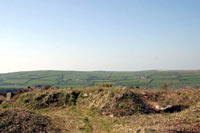
Sancreed Beacon is a granite upland, 172m above sea level, an historic monument close to Sancreed churchtown.
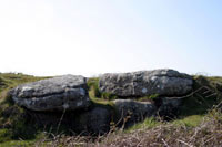
Evidence suggests that the Beacon was inhabited during the Bronze Age. Remains of two burial mounds (tumuli)are located on the summit and the remains of what is believed to be a Bronze Age hut stand on the Western slope.
Open works and old shafts provide evidence of the tin mining which was carried on here from "old men's workings" to the mines of the mid 19th century - Wheal Argus, also known as Beacon Mine.
The Beacon would have been used to set a fire for warning of invasion during the Napoleonic wars and it is possible that it was used to warn of the approach of the Spanish Armada.
Today, the gorse and bracken covered Beacon is home to a variety of wildlife including kestrels, buzzards, small mammals, lizards and adders.
All ATMs throughout Cornwall.
If the information on this website has been useful to you please consider a donation.
This easy to use travel planner makes it simple. Just add the location in Cornwall from where you are travelling and the destination you wish to travel to and it will provide full details of times, buses, trains and ferries to get you to your destination.
Location:
Located in West Cornwall. Sancreed Beacon is signposted from the village and is easily accessed from the A30 trunk road by following signs from Drift.
Road directions to Sancreed Beacon
Books online:
Click here to buy books online about Sancreed Beacon
Find all the Dog Friendly beaches in Cornwall
More archaeological sites in Cornwall
Places of interest in or around Sancreed BeaconTowns, villages and other locations |
Cornish phrases and place names |
Topical phrases of the month October: 'Festival Phrases'
Place Name of the Month October: Karrekreun – Cargreen

|
Sancreed Beacon Map |
|
Sancreed Beacon Events |
|
Sancreed Beacon Community Information |
|
Sancreed Beacon Books |
|
Sancreed Beacon Photos |
|
Sancreed Beacon Videos |
|
Sancreed Beacon History |
Sancreed Beacon
Accommodation
in or around Sancreed Beacon


|
|


